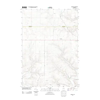
2013 Map of Arendahl
USGS Topo · Published 2013About this map
Arendahl serves as the focal point of this rural landscape in southeastern Minnesota, where the blufflands of the driftless area meet the agricultural plateau. The settlement is centered near the Arendahl Cem, while the southern reaches of the quadrangle descend into the broad valley of the Root River. This drainage system is fed by numerous spring-fed tributaries including Big Springs Cr and Torkelson Cr, which carve deep, winding valleys through the terrain. The map captures a transition between the open township roads of the north, such as TWP HWY 11 and TWP HWY 4, and the more complex topography of Lobland Valley to the south. Historically significant water sources like Big Springs remain prominent features, illustrating the area's reliance on the local hydrology for both early settlement and ongoing land use.
Find a feature on this map
21 named features on this map. Tap any name to fly to it.
Don’t see what you’re looking for? This feature index may not catch every label — zoom into the map to look around manually.
Map Details
Editions of this 2013 Arendahl Map
This is the sole edition of this map. No revisions or reprints were ever made.
Other maps of this area

1954 · Chatfield
USGS Topo · 1:62,500

1954 · Lewiston
USGS Topo · 1:62,500

1954 · Mason City
USGS Topo · 1:250,000

1957 · Mason City
USGS Topo · 1:250,000

1958 · Mason City
USGS Topo · 1:250,000

1958 · La Crosse
USGS Topo · 1:250,000

1961 · La Crosse
USGS Topo · 1:250,000

1965 · La Crosse
USGS Topo · 1:250,000

1965 · Bratsberg
USGS Topo · 1:24,000
1965 · Lanesboro
USGS Topo · 1:24,000