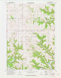
1974 Map of Arendahl
USGS Topo · Published 1976About this map
Minnesota Memorial Hardwood State Forest dominates this section of Fillmore County, where the deeply dissected plateau of southeastern Minnesota creates a complex drainage system. The Root River cuts through the southern reaches of the map, followed closely by the tracks of the C M St P & P railroad. This corridor historically provided a vital transport link through the bluff country, connecting the small settlement of Lanes to the wider region. In the uplands, the landscape transitions to agricultural use, centered around the community of Arendahl and the North Prairie Ch. The presence of multiple springs, such as Big Springs and Springs Creek, highlights the karst topography typical of this unglaciated region. Genealogists will find the Arendahl Cem particularly useful for tracing local family history in this rural township.
Find a feature on this map
25 named features on this map. Tap any name to fly to it.
Don’t see what you’re looking for? This feature index may not catch every label — zoom into the map to look around manually.
Map Details
Editions of this 1974 Arendahl Map
This is the sole edition of this map. No revisions or reprints were ever made.
Other maps of this area

1954 · Chatfield
USGS Topo · 1:62,500

1954 · Lewiston
USGS Topo · 1:62,500

1954 · Mason City
USGS Topo · 1:250,000

1957 · Mason City
USGS Topo · 1:250,000

1958 · Mason City
USGS Topo · 1:250,000

1958 · La Crosse
USGS Topo · 1:250,000

1961 · La Crosse
USGS Topo · 1:250,000

1965 · La Crosse
USGS Topo · 1:250,000

1965 · Bratsberg
USGS Topo · 1:24,000
1965 · Lanesboro
USGS Topo · 1:24,000