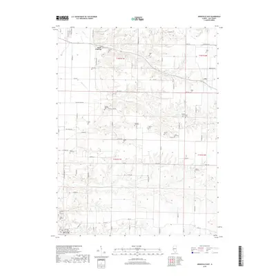
2018 Map of Arenzville East
USGS Topo · Published 2018About this map
Bluff Springs and the surrounding Cass County countryside are defined by a complex network of creeks and small family cemeteries. This 2018 survey documents the intricate drainage of Clear Cr, Prairie Cr, and Mannel Br, which carve through the land between the larger settlements of Arenzville and the crossroads at Jules. The map is particularly notable for its density of burial grounds, many of which reflect the heritage of early Methodist and Lutheran congregations, including the Jockisch Methodist Cem and Trinity Lutheran Cem. These small, localized features, alongside family landmarks like the William Nisbet Cem and James Davis Cem, offer a detailed picture of the region's genealogical and social history. The road network remains largely rural, following section lines and terrain contours with local paths like 6 Mile Rd and Old Highway Rd connecting the scattered homesteads.
Find a feature on this map
78 named features on this map. Tap any name to fly to it.
Don’t see what you’re looking for? This feature index may not catch every label — zoom into the map to look around manually.
Map Details
Editions of this 2018 Arenzville East Map
This is the sole edition of this map. No revisions or reprints were ever made.
Other maps of this area

1926 · Beardstown
USGS Topo · 1:62,500

1929 · Arenzville
USGS Topo · 1:62,500

1930 · Chandlerville
USGS Topo · 1:62,500

1932 · Arenzville
USGS Topo · 1:62,500

1932 · Chandlerville
USGS Topo · 1:62,500

1932 · Virginia
USGS Topo · 1:62,500

1936 · Virginia
USGS Topo · 1:62,500

1944 · Beardstown
USGS Topo · 1:62,500

1948 · Quincy
USGS Topo · 1:250,000

1956 · Quincy
USGS Topo · 1:250,000