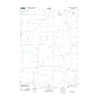
2012 Map of Arenzville West
USGS Topo · Published 2012About this map
Hagener sits at a crossroads in this agricultural landscape south of Beardstown, where drainage ditches and creek channels define the land's use. The area is characterized by a high concentration of historic burial grounds, including Saint Peters Lutheran Cem, Trinity Lutheran Cem, and the family-named Wagle Cem, suggesting a long-established rural community with deep ancestral roots. Aviation infrastructure is surprisingly prominent here, with the Greater Beardstown Airport and smaller strips like Krohe Airport and Kinsey RLA Airport dotting the terrain. The hydrological management of the region is evident in the engineered paths of Pankey Pond Ditch and South Beardstown Ditch, while the southern border is clearly defined by the Morgan Cass Cnty Line Rd, marking the boundary between Cass and Morgan counties.
Find a feature on this map
65 named features on this map. Tap any name to fly to it.
Don’t see what you’re looking for? This feature index may not catch every label — zoom into the map to look around manually.
Map Details
Editions of this 2012 Arenzville West Map
This is the sole edition of this map. No revisions or reprints were ever made.
Other maps of this area

1923 · Rushville
USGS Topo · 1:62,500

1926 · Beardstown
USGS Topo · 1:62,500

1926 · Rushville
USGS Topo · 1:62,500

1928 · Meredosia
USGS Topo · 1:62,500

1929 · Arenzville
USGS Topo · 1:62,500

1931 · Meredosia
USGS Topo · 1:62,500

1932 · Arenzville
USGS Topo · 1:62,500

1944 · Beardstown
USGS Topo · 1:62,500

1948 · Quincy
USGS Topo · 1:250,000

1956 · Quincy
USGS Topo · 1:250,000