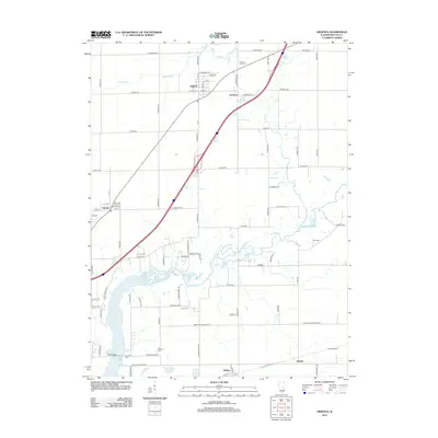
2012 Map of Argenta
USGS Topo · Published 2012About this map
The Sangamon River carves a winding path through this central Illinois landscape, defining the topography north of Oakley and Chapin. In this transition zone between agricultural fields and the burgeoning northern reaches of Lake Decatur, the settlement pattern reflects a deeply rooted local history. The village of Argenta serves as a primary hub in the north, while smaller communities like Oreana and Newburg anchor the surrounding townships.
Find a feature on this map
53 named features on this map. Tap any name to fly to it.
Don’t see what you’re looking for? This feature index may not catch every label — zoom into the map to look around manually.
Map Details
Editions of this 2012 Argenta Map
This is the sole edition of this map. No revisions or reprints were ever made.
Other maps of this area

1929 · Decatur
USGS Topo · 1:62,500

1933 · Decatur
USGS Topo · 1:62,500

1937 · Monticello
USGS Topo · 1:48,000

1943 · Monticello
USGS Topo · 1:62,500

1955 · Bement
USGS Topo · 1:62,500

1957 · Maroa
USGS Topo · 1:62,500

1958 · Peoria
USGS Topo · 1:250,000

1958 · Decatur
USGS Topo · 1:250,000

1961 · Peoria
USGS Topo · 1:250,000

1961 · Decatur
USGS Topo · 1:250,000