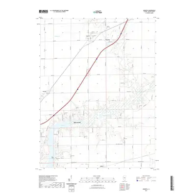
2021 Map of Argenta
USGS Topo · Published 2021About this map
Lake Decatur and the meandering Sangamon River anchor this central Illinois landscape, illustrating the water management and agricultural patterns of Macon County. The village of Argenta serves as a northern hub, while the residential expansion of Decatur pushes into the southwestern corner of the sheet. Between these points, the land is marked by small settlements like Oreana, Newburg, and Oakley, connected by a network of rural roads such as Jordan Rd and Cemetery Rd. Genealogists will find a high concentration of burial grounds, including Friends Creek Cem, Peck Cem, and the Ritchie Cem near the river bluffs. Landmarks like Reas Bridge and the marshy reaches of the Sangamon River bottomlands provide a clear view of how the natural terrain has been navigated and settled over generations.
Find a feature on this map
76 named features on this map. Tap any name to fly to it.
Don’t see what you’re looking for? This feature index may not catch every label — zoom into the map to look around manually.
Map Details
Editions of this 2021 Argenta Map
This is the sole edition of this map. No revisions or reprints were ever made.
Other maps of this area

1929 · Decatur
USGS Topo · 1:62,500

1933 · Decatur
USGS Topo · 1:62,500

1937 · Monticello
USGS Topo · 1:48,000

1943 · Monticello
USGS Topo · 1:62,500

1955 · Bement
USGS Topo · 1:62,500

1957 · Maroa
USGS Topo · 1:62,500

1958 · Peoria
USGS Topo · 1:250,000

1958 · Decatur
USGS Topo · 1:250,000

1961 · Peoria
USGS Topo · 1:250,000

1961 · Decatur
USGS Topo · 1:250,000