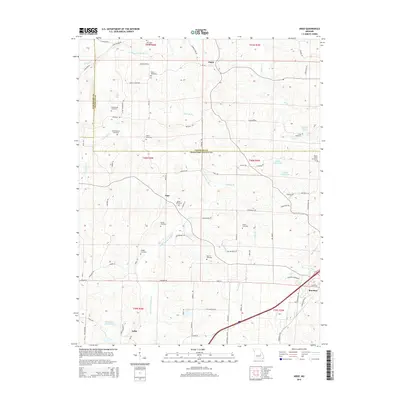
2015 Map of Argo
USGS Topo · Published 2015About this map
The Little Bourbeuse River winds through the heart of this Missouri landscape, defining the rural character of the borderlands between Franklin, Crawford, and Gasconade counties. The settlement patterns shown here are deeply tied to family legacies, evidenced by the high density of small family burial grounds such as Old Japan Cemetery, Walker Cemetery, and Bacon Cemetery. In the northern portion of the map, the community of Japan sits near the headwaters of Long Br, while the town of Bourbon occupies the southeastern corner. The transition from the more developed corridor near Bourbon to the scattered farms and creek bottoms like Opossum Cr and Rocky Br illustrates the mid-20th-century persistence of remote rural life. Water features including Nolie Lake North and Holmstrom North Lake dot the ridges above the river valley, showing later alterations to the natural drainage.
Find a feature on this map
90 named features on this map. Tap any name to fly to it.
Don’t see what you’re looking for? This feature index may not catch every label — zoom into the map to look around manually.
Map Details
Editions of this 2015 Argo Map
This is the sole edition of this map. No revisions or reprints were ever made.
Other maps of this area

1903 · Sullivan
USGS Topo · 1:125,000

1935 · Gerald
USGS Topo · 1:48,000

1941 · Gerald
USGS Topo · 1:62,500

1944 · Gerald
USGS Topo · 1:62,500

1946 · Union
USGS Topo · 1:62,500

1947 · Sullivan
USGS Topo · 1:62,500

1948 · Cuba
USGS Topo · 1:24,000

1948 · Leasburg
USGS Topo · 1:24,000

1948 · Argo
USGS Topo · 1:24,000

1948 · Union
USGS Topo · 1:62,500