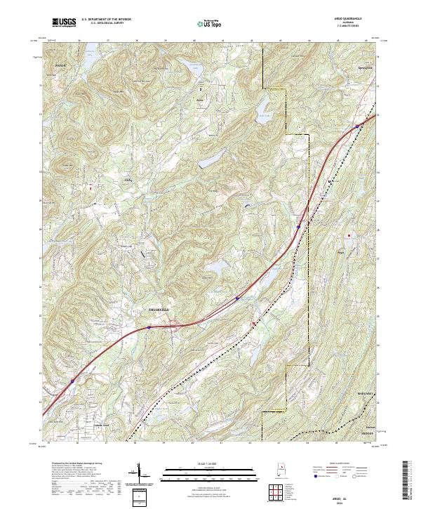
2024 Map of Argo
USGS Topo · Published 2024About this map
Trussville and Argo serve as the primary hubs in this corner of Jefferson and St. Clair Counties, where the terrain is defined by a series of northeast-trending ridges such as Pine Ridge, Chinquapin Ridge, and Red Mountain. The Cahaba River and Little Cahaba Creek drain the southwestern portions of the map, while Big Canoe Creek flows through the northern reaches near Ayres. This modern survey illustrates the persistent rural-suburban interface of the region, featuring numerous small impoundments like Echo Lake, Quickhaven Lake, and Wilborn Lake that dot the landscape between residential developments.
Find a feature on this map
206 named features on this map. Tap any name to fly to it.
Don’t see what you’re looking for? This feature index may not catch every label — zoom into the map to look around manually.
Map Details
Editions of this 2024 Argo Map
This is the sole edition of this map. No revisions or reprints were ever made.
Other maps of this area

1889 · Springville
USGS Topo · 1:125,000

1889 · Birmingham
USGS Topo · 1:125,000

1892 · Birmingham
USGS Topo · 1:125,000

1892 · Springville
USGS Topo · 1:125,000

1895 · Birmingham
USGS Topo · 1:125,000

1905 · Leeds
USGS Topo · 1:62,500

1907 · Birmingham
USGS Topo · 1:125,000

1907 · Leeds
USGS Topo · 1:62,500

1953 · Birmingham
USGS Topo · 1:250,000

1956 · Birmingham
USGS Topo · 1:250,000