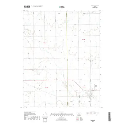
2018 Map of Argonia
USGS Topo · Published 2018About this map
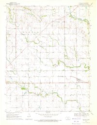
Argonia serves as the primary hub for this portion of the Kansas plains, situated in the southeastern corner of the map. The landscape is defined by the agricultural grid and the various waterways that thread through it, including Argonia Cr and Spring Cr, which join with Sand Cr south of the town center. Local history and genealogy interest is concentrated near the settlement, where the Argonia Cem is clearly marked. The map also captures the Argonia Municipal Airport just north of town, reflecting the local infrastructure. This 2018 survey illustrates the persistent rural character of the area, noting the boundary where Harper Co meets Sumner Co along the western edge of the quadrangle. The grid of section roads, such as N Blackstone Rd and W 10th Ave, provides a clear view of land divisions and property access across the prairie.
Find a feature on this map
43 named features on this map. Tap any name to fly to it.
Don’t see what you’re looking for? This feature index may not catch every label — zoom into the map to look around manually.
Map Details
Editions of this 2018 Argonia Map
This is the sole edition of this map. No revisions or reprints were ever made.
Other maps of this area

1889 · Caldwell
USGS Topo · 1:125,000

1893 · Caldwell
USGS Topo · 1:125,000

1897 · Caldwell
USGS Topo · 1:125,000

1955 · Wichita
USGS Topo · 1:250,000

1958 · Wichita
USGS Topo · 1:250,000
1971 · Norwich
USGS Topo · 1:24,000

1971 · Caldwell NW
USGS Topo · 1:24,000
1971 · Adams
USGS Topo · 1:24,000
1971 · Argonia
USGS Topo · 1:24,000
1971 · Danville
USGS Topo · 1:24,000