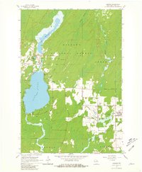
1965 Map of Argonne
USGS Topo · Published 1981About this map
Pine Lake and the industrial remnants of the Nicolet National Forest define this landscape in the mid-1960s. The settlement of Hiles occupies the northern shores, where the Hiles Millpond and an old Railroad Grade point to a history of timber and transport. In the eastern portion of the map, the town of Argonne serves as a local hub near the Soo Line tracks, with Wisconsin Junction marking a nearby rail intersection. The terrain is deeply hydrological, characterized by the sprawling Island Swamp and the headwaters of the North Branch, West Branch, and Middle Branch Peshtigo Rivers. Genealogists will find several burial grounds, including Hiles Cem, Argonne Cem, and St Marys Cem, while the Hiles Lookout Tower stands as a prominent landmark for forest fire observation during this era.
Find a feature on this map
31 named features on this map. Tap any name to fly to it.
Don’t see what you’re looking for? This feature index may not catch every label — zoom into the map to look around manually.
Map Details
Editions of this 1965 Argonne Map
2 editions found
Other maps of this area

1928 · Three Lakes
USGS Topo · 1:48,000

1938 · Alvin
USGS Topo · 1:48,000

1938 · Three Lakes
USGS Topo · 1:48,000

1939 · Crandon
USGS Topo · 1:48,000

1940 · Monico
USGS Topo · 1:48,000

1941 · Crandon
USGS Topo · 1:48,000

1945 · Three Lakes
USGS Topo · 1:48,000

1946 · Alvin
USGS Topo · 1:48,000

1947 · Crandon
USGS Topo · 1:48,000

1950 · Monico
USGS Topo · 1:48,000