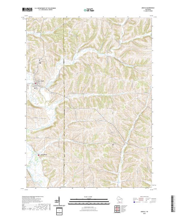
2022 Map of Argyle
USGS Topo · Published 2022About this map
The East Branch Pecatonica River winds through the southwestern corner of this Lafayette County landscape, serving as a primary drainage point for a network of creeks including Trotter Br and Jordan Cr. In the village of Argyle, the street grid is well-defined by E Milwaukee St and Monroe St, situated just west of the bend in Dougherty Cr. This area is characterized by significant topographic relief, with named depressions like Puddledock Hollow and Jockey Hollow carving through the uplands. Genealogists will find several burial sites including Old Argyle Cem and Calvary Cem north of the village. Further south, the settlement of Woodford sits near the riverbanks, marking a distinct community hub amidst the intersecting rural routes such as Co HWY Y and Co RD C.
Find a feature on this map
64 named features on this map. Tap any name to fly to it.
Don’t see what you’re looking for? This feature index may not catch every label — zoom into the map to look around manually.
Map Details
Editions of this 2022 Argyle Map
This is the sole edition of this map. No revisions or reprints were ever made.
Other maps of this area

1920 · Monroe
USGS Topo · 1:62,500

1922 · Monroe
USGS Topo · 1:62,500

1923 · Blanchardville
USGS Topo · 1:62,500

1923 · New Glarus
USGS Topo · 1:62,500

1923 · South Wayne
USGS Topo · 1:62,500

1954 · Rockford
USGS Topo · 1:250,000

1955 · Rockford
USGS Topo · 1:250,000

1958 · Rockford
USGS Topo · 1:250,000
1962 · New Glarus
USGS Topo · 1:62,500
1962 · Monroe NW
USGS Topo · 1:24,000