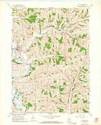
1962 Map of Argyle
USGS Topo · Published 1964About this map
The East Branch Pecatonica River snakes through the driftless-style topography of the Lafayette and Green County border, anchoring the valley settlement of Argyle. In the early 1960s, the village landscape is marked by the presence of the Illinois Central Railroad and a prominent water tank on the hill overlooking the river bend. Further south, the small community of Woodford sits along the rail line, while Jordan Center serves as a rural crossroads to the east.
Find a feature on this map
32 named features on this map. Tap any name to fly to it.
Don’t see what you’re looking for? This feature index may not catch every label — zoom into the map to look around manually.
Map Details
Editions of this 1962 Argyle Map
This is the sole edition of this map. No revisions or reprints were ever made.
Other maps of this area

1920 · Monroe
USGS Topo · 1:62,500

1922 · Monroe
USGS Topo · 1:62,500

1923 · Blanchardville
USGS Topo · 1:62,500

1923 · New Glarus
USGS Topo · 1:62,500

1923 · South Wayne
USGS Topo · 1:62,500

1954 · Rockford
USGS Topo · 1:250,000

1955 · Rockford
USGS Topo · 1:250,000

1958 · Rockford
USGS Topo · 1:250,000
1962 · New Glarus
USGS Topo · 1:62,500
1962 · Monroe NW
USGS Topo · 1:24,000