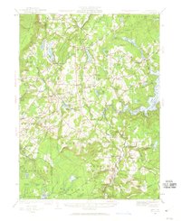
1928 Map of Ariel
USGS Topo · Published 1960About this map
The Moosic Mountains anchor the western edge of this landscape, where the Delaware Lackawanna and Western RR cuts through the terrain near Lehigh. The area is defined by its complex network of water and early 20th-century industry, notably around Lake Wallenpaupack and Lake Ariel. The map illustrates a rural economy transitioning from timber and milling to seasonal lakeside communities, with numerous family-named landmarks like Haas Mill and Tresslers Corners marking the intersections of local life.
Find a feature on this map
121 named features on this map. Tap any name to fly to it.
Don’t see what you’re looking for? This feature index may not catch every label — zoom into the map to look around manually.
Map Details
Editions of this 1928 Ariel Map
4 editions found

Other maps of this area

1889 · Scranton
USGS Topo · 1:62,500

1891 · Scranton
USGS Topo · 1:62,500

1892 · Honesdale
USGS Topo · 1:62,500

1892 · Dundaff
USGS Topo · 1:62,500

1893 · Scranton
USGS Topo · 1:62,500

1919 · Pocono
USGS Topo · 1:62,500

1920 · Damascus
USGS Topo · 1:62,500

1921 · Pocono
USGS Topo · 1:62,500

1922 · Stoddartsville
USGS Topo · 1:62,500

1923 · Damascus
USGS Topo · 1:62,500
Featured Places
- Cherry Ridge Township, PA
- South Canaan Township, PA
- Sterling Township, PA
- Clifton Township, PA
- Lake Township, PA