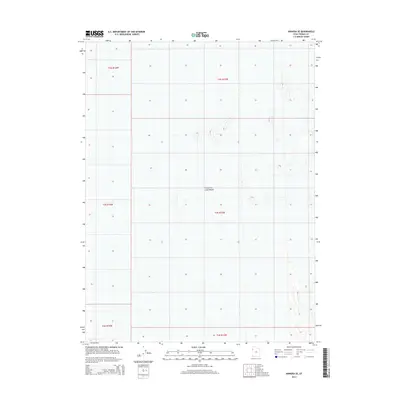
2014 Map of Arinosa SE
USGS Topo · Published 2014About this map
The Great Salt Lake Desert dominates this landscape, its flat expanse of sediment and salt crust defined by the vast horizons of western Tooele County. This 2014 survey captures the region's distinctive topography, where minimal elevation changes are carefully documented against the backdrop of the Bureau of Land Management's Public Land Survey System. The map illustrates the geometric layout of townships and ranges, including t2s r15w, t3s r15w, and t4s r15w, which grid the seemingly featureless terrain. These cadastral boundaries are essential for researchers tracking land ownership and government management within this specialized desert environment.
Find a feature on this map
7 named features on this map. Tap any name to fly to it.
Don’t see what you’re looking for? This feature index may not catch every label — zoom into the map to look around manually.
Map Details
Editions of this 2014 Arinosa SE Map
This is the sole edition of this map. No revisions or reprints were ever made.
Other maps of this area

1953 · Tooele
USGS Topo · 1:250,000

1955 · Tooele
USGS Topo · 1:250,000

1973 · Knolls SW
USGS Topo · 1:24,000

1973 · Arinosa
USGS Topo · 1:24,000

1973 · Arinosa SE
USGS Topo · 1:24,000

1973 · Arinosa SW
USGS Topo · 1:24,000

1973 · Arinosa NE
USGS Topo · 1:24,000

1973 · Wildcat Mountain NW
USGS Topo · 1:24,000

1973 · Barro
USGS Topo · 1:24,000

1973 · Gold Hill 1 NE
USGS Topo · 1:24,000