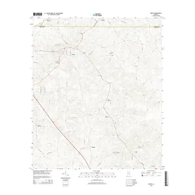
2014 Map of Ariton
USGS Topo · Published 2014About this map
Ariton serves as the central hub for this portion of Southeast Alabama, situated along the border of Barbour and Dale counties. The town's grid is defined by streets like Atlantic St and W Main St, reflecting its historic alignment with regional transportation. The surrounding landscape is a network of small agricultural settlements and family-named landmarks, including Barnes, Dillard, and Dill. Genealogists will find a high density of burial grounds throughout the area, from the Universalist Cem near town to more remote sites like Post Oak Cem and Center Ridge Cem. Water is integral to the terrain, with Claybank Cr and Bear Cr winding through the countryside, feeding into local impoundments such as W G Barnes Lake and Jernegans Pond.
Find a feature on this map
86 named features on this map. Tap any name to fly to it.
Don’t see what you’re looking for? This feature index may not catch every label — zoom into the map to look around manually.
Map Details
Editions of this 2014 Ariton Map
This is the sole edition of this map. No revisions or reprints were ever made.
Other maps of this area

1942 · Enterprise
USGS Topo · 1:125,000

1948 · Ozark
USGS Topo · 1:62,500

1948 · Brundidge
USGS Topo · 1:62,500

1950 · Ozark
USGS Topo · 1:62,500

1950 · Enterprise
USGS Topo · 1:62,500

1950 · Brundidge
USGS Topo · 1:62,500

1953 · Dothan
USGS Topo · 1:250,000

1954 · Dothan
USGS Topo · 1:250,000

1955 · Dothan
USGS Topo · 1:250,000

1960 · Ewell
USGS Topo · 1:24,000