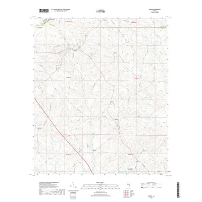
2018 Map of Ariton
USGS Topo · Published 2018About this map
Ariton serves as the primary hub of this landscape, situated near the intersection of Clio Rd and W Main St. The surrounding countryside in Dale, Pike, and Barbour counties is defined by a dense network of creeks including Claybank Cr, Pea River, and Sevenmile Cr. This area is particularly rich for genealogical research, documenting numerous small burial grounds like the Universalist Cem, Center Ridge Cem, and Post Oak Cem that anchor the various rural communities. Small settlements such as Bethel, Barnes, and Dillard dot the landscape, while the southern edge of the survey reaches into the northern outskirts of Ozark. Water features like W G Barnes Lake and Marvin Parker Lake Number Two suggest a history of local land management and private water rights throughout this agricultural region.
Find a feature on this map
95 named features on this map. Tap any name to fly to it.
Don’t see what you’re looking for? This feature index may not catch every label — zoom into the map to look around manually.
Map Details
Editions of this 2018 Ariton Map
This is the sole edition of this map. No revisions or reprints were ever made.
Other maps of this area

1942 · Enterprise
USGS Topo · 1:125,000

1948 · Ozark
USGS Topo · 1:62,500

1948 · Brundidge
USGS Topo · 1:62,500

1950 · Ozark
USGS Topo · 1:62,500

1950 · Enterprise
USGS Topo · 1:62,500

1950 · Brundidge
USGS Topo · 1:62,500

1953 · Dothan
USGS Topo · 1:250,000

1954 · Dothan
USGS Topo · 1:250,000

1955 · Dothan
USGS Topo · 1:250,000

1960 · Ewell
USGS Topo · 1:24,000