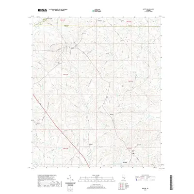
2020 Map of Ariton
USGS Topo · Published 2020About this map
Ariton serves as a central hub in this southeast Alabama landscape, where the confluence of several local roads and the Pea River define the region's geography. The map documents a predominantly rural patchwork of creek-fed valleys including Bear Cr and Claybank Cr, interspersed with small settlements like Barnes, Dillard, and Bethel. Genealogists will find significant value in the numerous recorded burial sites, such as Sammon Cem, Richardson Cem, and the Post Oak Baptist Church Cem near Dill. The northern reaches of Ozark appear at the southern edge, showing the expansion of the county seat toward the timbered hills and agricultural lands. Notable water features like W G Barnes Lake and Marvin Parker Lake Number Two highlight the local hydrology and land use patterns of Dale and Barbour Counties in the early twenty-first century.
Find a feature on this map
93 named features on this map. Tap any name to fly to it.
Don’t see what you’re looking for? This feature index may not catch every label — zoom into the map to look around manually.
Map Details
Editions of this 2020 Ariton Map
This is the sole edition of this map. No revisions or reprints were ever made.
Other maps of this area

1942 · Enterprise
USGS Topo · 1:125,000

1948 · Ozark
USGS Topo · 1:62,500

1948 · Brundidge
USGS Topo · 1:62,500

1950 · Ozark
USGS Topo · 1:62,500

1950 · Enterprise
USGS Topo · 1:62,500

1950 · Brundidge
USGS Topo · 1:62,500

1953 · Dothan
USGS Topo · 1:250,000

1954 · Dothan
USGS Topo · 1:250,000

1955 · Dothan
USGS Topo · 1:250,000

1960 · Ewell
USGS Topo · 1:24,000