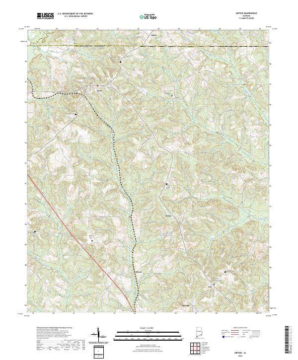
2024 Map of Ariton
USGS Topo · Published 2024About this map
Ariton serves as a central hub in this corner of Dale County, situated where the northern boundary meets Barbour County. This rural landscape is defined by its deep spiritual and community roots, evidenced by the numerous burial grounds scattered across the terrain, including Universalist Cem and Mossy Grove Cem. The settlement pattern follows the gentle ridges between water systems like Sandy Creek and Beaver Creek, with smaller locales such as Barnes and Dillard anchored by local landmarks like W G Barnes Lake. To the south, the map reaches the outskirts of Ozark, while the presence of Post Oak Baptist Church and its associated Post Oak Baptist Church Cem highlights the enduring role of church congregations in organizing this Alabama countryside.
Find a feature on this map
56 named features on this map. Tap any name to fly to it.
Don’t see what you’re looking for? This feature index may not catch every label — zoom into the map to look around manually.
Map Details
Editions of this 2024 Ariton Map
This is the sole edition of this map. No revisions or reprints were ever made.
Other maps of this area

1942 · Enterprise
USGS Topo · 1:125,000

1948 · Ozark
USGS Topo · 1:62,500

1948 · Brundidge
USGS Topo · 1:62,500

1950 · Ozark
USGS Topo · 1:62,500

1950 · Enterprise
USGS Topo · 1:62,500

1950 · Brundidge
USGS Topo · 1:62,500

1953 · Dothan
USGS Topo · 1:250,000

1954 · Dothan
USGS Topo · 1:250,000

1955 · Dothan
USGS Topo · 1:250,000

1960 · Ewell
USGS Topo · 1:24,000