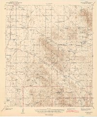
1943 Map of Arivaca
USGS Topo · Published 1943About this map
Arivaca serves as the central hub of this Arizona mining and ranching landscape, which was surveyed during the early 1940s. The map reveals an intensive history of mineral exploration throughout the Las Guijas Mountains and Cerro Colorado Mountains, evidenced by a dense concentration of mining sites such as the Cerro Colorado Mine and the Mary G Mine. The prevalence of labels marked as abandoned, including the Liberty Mine and Colorado Clark Mine, suggests a shift in the local economy as earlier silver and gold strikes gave way to more permanent ranching operations. Numerous family-named homesteads and camps, such as Figueroa Ranch and Montana Ranch, are scattered along the seasonal drainage systems of Arivaca Wash and Altar Wash. These locations, alongside small settlements like Puertocito and Las Guijas, provide valuable data for genealogists tracing the early 20th-century inhabitants of the Pima and Santa Cruz county borderlands.
Find a feature on this map
89 named features on this map. Tap any name to fly to it.
Don’t see what you’re looking for? This feature index may not catch every label — zoom into the map to look around manually.
Map Details
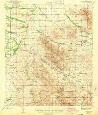
Editions of this 1943 Arivaca Map
3 editions found

Other maps of this area

1920 · Arivaca
USGS Topo · 1:125,000

1921 · Old Glory
USGS Topo · 1:125,000

1925 · Samaniego Peak
USGS Topo · 1:62,500

1939 · Twin Buttes
USGS Topo · 1:62,500

1939 · Tubac
USGS Topo · 1:62,500

1940 · Palo Alto Ranch
USGS Topo · 1:62,500

1941 · Presumido Peak
USGS Topo · 1:62,500

1941 · Twin Buttes
USGS Topo · 1:62,500

1941 · Baboquivari Peak
USGS Topo · 1:62,500

1941 · Arivaca
USGS Topo · 1:62,500