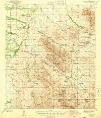
1943 Map of Arivaca
USGS Topo · Published 1956About this map
Arivaca serves as the central hub of this Arizona landscape, situated in a valley surrounded by the formidable Las Guijas Mountains and San Luis Mountains. The 1940s economy of this border region is clearly defined by a legacy of hard-rock mining and cattle ranching. Extensive mineral exploration is evident in the cluster of workings around Cerro Colorado, including the Cerro Colorado Mine and the Colorado Clark (abandoned) Mine. Further south, the presence of numerous family-named cattle operations like Campos Ranch and Figueroa Ranch suggests a network of early homesteads reliant on scattered water sources such as Cienaguita Spr. The rugged southern terrain is dominated by the Coronado National Forest and the Cobre Ridge, where isolated sites like the Alaska Mine (abandoned) highlight the difficulty of extraction in the high desert.
Find a feature on this map
61 named features on this map. Tap any name to fly to it.
Don’t see what you’re looking for? This feature index may not catch every label — zoom into the map to look around manually.
Map Details
Editions of this 1943 Arivaca Map
3 editions found

Other maps of this area

1920 · Arivaca
USGS Topo · 1:125,000

1921 · Old Glory
USGS Topo · 1:125,000

1925 · Samaniego Peak
USGS Topo · 1:62,500

1939 · Twin Buttes
USGS Topo · 1:62,500

1939 · Tubac
USGS Topo · 1:62,500

1940 · Palo Alto Ranch
USGS Topo · 1:62,500

1941 · Presumido Peak
USGS Topo · 1:62,500

1941 · Twin Buttes
USGS Topo · 1:62,500

1941 · Baboquivari Peak
USGS Topo · 1:62,500

1941 · Arivaca
USGS Topo · 1:62,500