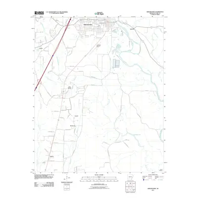
2011 Map of Arkadelphia
USGS Topo · Published 2011About this map
Arkadelphia sits at the heart of this Clark County landscape, where the Ouachita River snakes along the eastern edge of the city. The settlement pattern reflects a mix of traditional neighborhoods and rural extensions, with the Arkadelphia Post Office and Rose Hill Cemetery serving as core landmarks. The southern reach of the quadrangle transitions into a network of small communities such as Gum Springs, Richwoods, and Midway, all connected by a dense web of local routes like Hasley Rd and County Rd-19.
Find a feature on this map
84 named features on this map. Tap any name to fly to it.
Don’t see what you’re looking for? This feature index may not catch every label — zoom into the map to look around manually.
Map Details
Editions of this 2011 Arkadelphia Map
This is the sole edition of this map. No revisions or reprints were ever made.
Other maps of this area

1901 · Gurdon
USGS Topo · 1:125,000

1903 · Camden
USGS Topo · 1:125,000

1953 · El Dorado
USGS Topo · 1:250,000

1955 · Little Rock
USGS Topo · 1:250,000

1956 · Little Rock
USGS Topo · 1:250,000

1957 · El Dorado
USGS Topo · 1:250,000

1958 · El Dorado
USGS Topo · 1:250,000

1959 · Caddo Valley
USGS Topo · 1:24,000

1959 · Arkadelphia
USGS Topo · 1:24,000

1960 · El Dorado
USGS Topo · 1:250,000