2024 Map of Arkadelphia
USGS Topo · Published 2024About this map
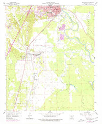
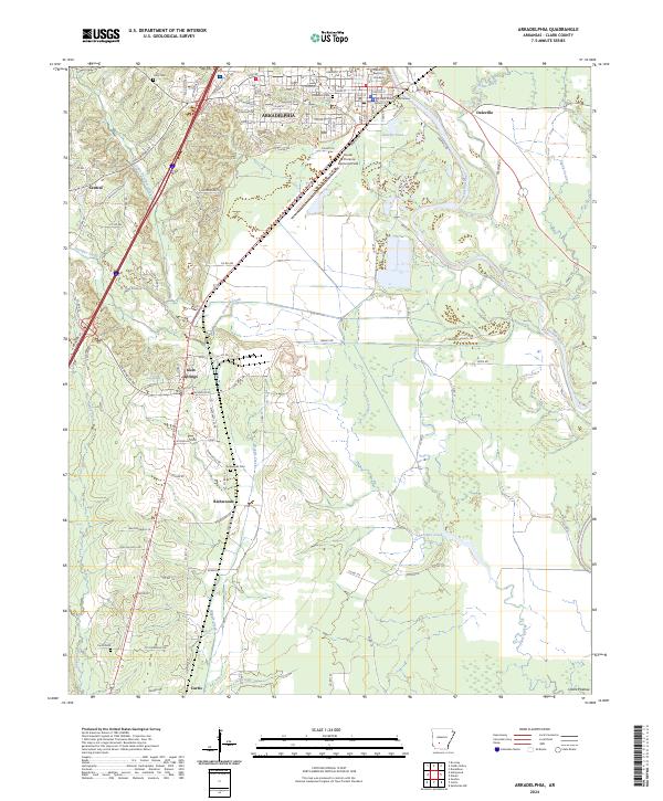
Arkadelphia serves as the primary hub of this Arkansas landscape, defined by the winding course of the Ouachita River and its varied tributaries like Little Deceiver Creek and Waggle Creek. The city's northern reaches are anchored by the Ouachita Baptist University campus and the historic Clark County Courthouse, while the surrounding countryside transitions into smaller settlements and rural crossroads. The distribution of family and community spaces is evident through several local burial grounds, including Rose Hill Cem and Richwoods Cem, which provide essential points of reference for genealogists. To the south and west, the map details the outlying communities of Gum Springs and Curtis. The topography begins its descent toward the Ozark Plateau, reflected in the drainage patterns of Caney Creek and Saline Bayou. Infrastructure such as Dexter B Florence Memorial Field and a dense network of county roads illustrates the ongoing development and connectivity within Clark County.
Find a feature on this map
94 named features on this map. Tap any name to fly to it.
Don’t see what you’re looking for? This feature index may not catch every label — zoom into the map to look around manually.
Map Details
Editions of this 2024 Arkadelphia Map
This is the sole edition of this map. No revisions or reprints were ever made.
Historical Maps of Daleville Through Time
3 maps found