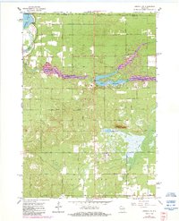
1967 Map of Arkdale NE
USGS Topo · Published 1984About this map
Petenwell Flowage defines the northwest corner of this central Wisconsin landscape, where the waters of Chester Creek and Fourteenmile Creek meet the reservoir. The mid-1960s survey, updated in the early 1980s, reveals a developing recreational and agricultural geography in the townships of Saratoga, Rome, and Big Flats. Notable for local historians are the Spring Branch Cem and Niebull Cem, alongside the Zion Ch in the south. The area's topography is marked by distinctive elevations and utility landmarks, including the Dorro Couche Lookout Tower near Dorro Couche Lake and the Nekoosa Lookout Tower to the north. Evidence of seasonal tourism and outdoor recreation is visible through the Ski Lifts, Ski Jump, and Campground facilities near the modern waters of Lake Sherwood.
Find a feature on this map
33 named features on this map. Tap any name to fly to it.
Don’t see what you’re looking for? This feature index may not catch every label — zoom into the map to look around manually.
Map Details
Editions of this 1967 Arkdale NE Map
2 editions found
Other maps of this area

1955 · Green Bay
USGS Topo · 1:250,000

1957 · Wisconsin Rapids
USGS Topo · 1:48,000

1957 · Whiting
USGS Topo · 1:48,000

1958 · Arkdale
USGS Topo · 1:48,000

1958 · Coloma
USGS Topo · 1:48,000

1967 · Roche A Cri
USGS Topo · 1:24,000

1967 · Arkdale NE
USGS Topo · 1:24,000

1967 · Wisconsin Rapids
USGS Topo · 1:62,500
1967 · Arkdale
USGS Topo · 1:24,000

1968 · Coloma NW
USGS Topo · 1:24,000