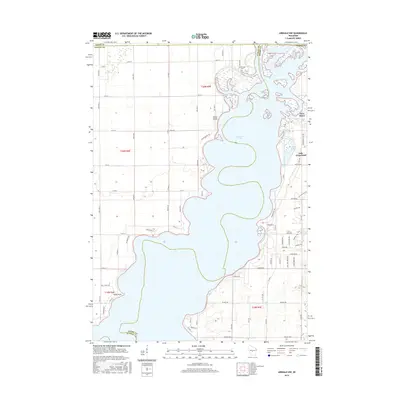
2015 Map of Arkdale NW
USGS Topo · Published 2015About this map
Petenwell Lake dominates this central Wisconsin landscape, where the Wisconsin River corridor forms the boundary between Juneau and Adams counties. The settlement of New Rome sits near the eastern shore, positioned at the junction where Fourteenmile Creek feeds into the larger reservoir. This mid-2010s survey illustrates a heavily subdivided recreation and residential area along the lake's edge, contrasting with the organized grid of agricultural and forest land to the west. On the eastern side, residential development is concentrated around Lake Arrowhead and the Twin Lakes, featuring an intricate network of local roads like Apache Ave and Sir Winston Trl. Near the northern county line, Greenwood Cem serves as a historical marker for the local community, while the southwestern shore features landforms like Halls Point and the prominent Yellow Banks bluffs overlooking the water.
Find a feature on this map
50 named features on this map. Tap any name to fly to it.
Don’t see what you’re looking for? This feature index may not catch every label — zoom into the map to look around manually.
Map Details
Editions of this 2015 Arkdale NW Map
This is the sole edition of this map. No revisions or reprints were ever made.
Other maps of this area

1953 · Eau Claire
USGS Topo · 1:250,000

1955 · Green Bay
USGS Topo · 1:250,000

1957 · Wisconsin Rapids
USGS Topo · 1:48,000

1957 · Pittsville
USGS Topo · 1:48,000

1958 · Eau Claire
USGS Topo · 1:250,000

1958 · Arkdale
USGS Topo · 1:48,000

1958 · Necedah
USGS Topo · 1:48,000

1964 · Eau Claire
USGS Topo · 1:250,000

1967 · Roche A Cri
USGS Topo · 1:24,000

1967 · Arkdale NE
USGS Topo · 1:24,000