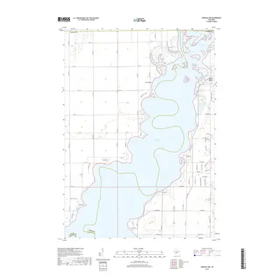
2018 Map of Arkdale NW
USGS Topo · Published 2018About this map
Petenwell Lake dominates this central Wisconsin landscape, illustrating how the Wisconsin River was harnessed for power and recreation by the early 21st century. The map captures the interface between Adams and Juneau counties, where the sprawling reservoir meets the sandy terrain of Yellow Banks. The settlement of New Rome sits near the confluence where Fourteenmile Creek enters the lake, serving as a focal point for the surrounding residential developments.
Find a feature on this map
38 named features on this map. Tap any name to fly to it.
Don’t see what you’re looking for? This feature index may not catch every label — zoom into the map to look around manually.
Map Details
Editions of this 2018 Arkdale NW Map
This is the sole edition of this map. No revisions or reprints were ever made.
Other maps of this area

1953 · Eau Claire
USGS Topo · 1:250,000

1955 · Green Bay
USGS Topo · 1:250,000

1957 · Wisconsin Rapids
USGS Topo · 1:48,000

1957 · Pittsville
USGS Topo · 1:48,000

1958 · Eau Claire
USGS Topo · 1:250,000

1958 · Arkdale
USGS Topo · 1:48,000

1958 · Necedah
USGS Topo · 1:48,000

1964 · Eau Claire
USGS Topo · 1:250,000

1967 · Roche A Cri
USGS Topo · 1:24,000

1967 · Arkdale NE
USGS Topo · 1:24,000