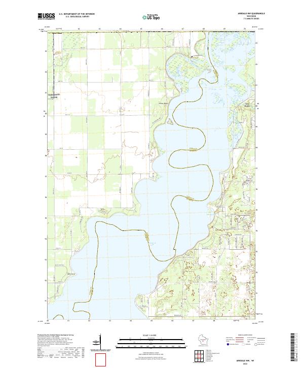
2022 Map of Arkdale NW
USGS Topo · Published 2022About this map
Petenwell Lake dominates this central Wisconsin landscape, where the waters of the Wisconsin River broaden significantly along the border of Juneau and Adams Counties. This modern survey illustrates the lake's intricate shoreline, including the indentations of Barnum Bay and the elevated terrain of the Yellow Banks. The settlement of New Rome is visible on the eastern shore, characterized by a dense grid of residential roads such as Apache Ave and Aniwa Ct.
Find a feature on this map
46 named features on this map. Tap any name to fly to it.
Don’t see what you’re looking for? This feature index may not catch every label — zoom into the map to look around manually.
Map Details
Editions of this 2022 Arkdale NW Map
This is the sole edition of this map. No revisions or reprints were ever made.
Other maps of this area

1953 · Eau Claire
USGS Topo · 1:250,000

1955 · Green Bay
USGS Topo · 1:250,000

1957 · Wisconsin Rapids
USGS Topo · 1:48,000

1957 · Pittsville
USGS Topo · 1:48,000

1958 · Eau Claire
USGS Topo · 1:250,000

1958 · Arkdale
USGS Topo · 1:48,000

1958 · Necedah
USGS Topo · 1:48,000

1964 · Eau Claire
USGS Topo · 1:250,000

1967 · Roche A Cri
USGS Topo · 1:24,000

1967 · Arkdale NE
USGS Topo · 1:24,000