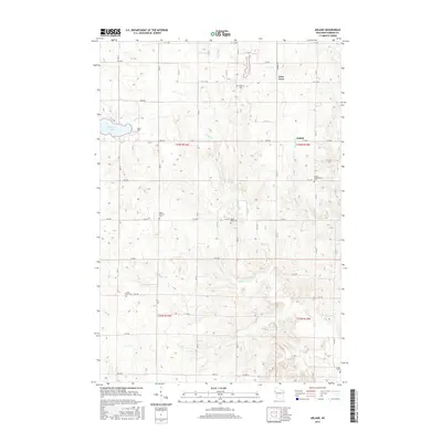
2015 Map of Arland
USGS Topo · Published 2015About this map
Turtle Creek and its many tributaries, including Moon Cr, Silver Cr, and Jones Cr, carve a complex drainage pattern across this Barron County landscape. The settlement of Arland sits near the eastern edge, while Twin Town is situated to the north. A striking concentration of community burial sites is distributed throughout the township, providing a rich record for family historians and genealogists. These include Bethany Cem, Saint Charles Cem, and the Arland Independent Cem. The terrain is characterized by numerous small basins and glacial features, such as Big Moon Lake and Musket Lake. The map reveals a highly structured grid of section roads, including Co Rd D and Co Hwy A, that define the modern agricultural character of the region.
Find a feature on this map
43 named features on this map. Tap any name to fly to it.
Don’t see what you’re looking for? This feature index may not catch every label — zoom into the map to look around manually.
Map Details
Editions of this 2015 Arland Map
This is the sole edition of this map. No revisions or reprints were ever made.
Other maps of this area

1948 · Downing
USGS Topo · 1:62,500

1949 · Ridgeland
USGS Topo · 1:62,500

1950 · Downing
USGS Topo · 1:62,500

1950 · Turtle Lake
USGS Topo · 1:62,500

1951 · Ridgeland
USGS Topo · 1:62,500

1951 · Barron
USGS Topo · 1:62,500

1952 · Turtle Lake
USGS Topo · 1:62,500

1953 · Rice Lake
USGS Topo · 1:250,000

1953 · Stillwater
USGS Topo · 1:250,000

1955 · Stillwater
USGS Topo · 1:250,000