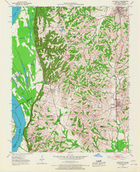
1951 Map of Arlington
USGS Topo · Published 1968About this map
Belmont Battlefield State Park anchors the southwestern edge of this landscape where the Mississippi River creates a complex system of oxbow lakes and wetlands along the Kentucky-Missouri border. The river's influence is evident in the numerous water bodies such as Indian Camp Lake, Fish Lake, and Goose Pond that fill the low-lying bottomlands. To the east, the terrain transitions into a more developed upland corridor defined by the parallel paths of the Illinois Central and Gulf Mobile and Ohio railroads. These rail lines connect the primary settlements of Arlington, Columbus, and Bardwell. Local rural life is well-documented through scattered landmarks like Beech Grove Ch, Webbs Chapel, and the Trevathan Sch, providing a detailed look at the social infrastructure of Carlisle and Hickman Counties in the early 1950s.
Find a feature on this map
41 named features on this map. Tap any name to fly to it.
Don’t see what you’re looking for? This feature index may not catch every label — zoom into the map to look around manually.
Map Details
Editions of this 1951 Arlington Map
2 editions found
Other maps of this area

1939 · Wickliffe
USGS Topo · 1:62,500

1939 · Hickman
USGS Topo · 1:62,500

1951 · Blandville
USGS Topo · 1:24,000

1951 · Oakton
USGS Topo · 1:24,000

1951 · Wolf Island
USGS Topo · 1:24,000

1951 · Wickliffe SW
USGS Topo · 1:24,000

1951 · Arlington
USGS Topo · 1:24,000

1951 · Wickliffe
USGS Topo · 1:24,000

1951 · Milburn
USGS Topo · 1:24,000

1952 · Clinton
USGS Topo · 1:24,000