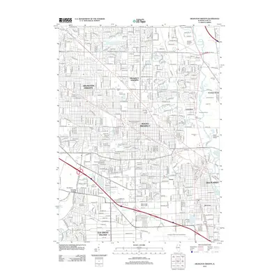
2012 Map of Arlington Heights
USGS Topo · Published 2012About this map
Arlington Heights and its neighboring municipalities of Mount Prospect and Des Plaines dominate this densely developed landscape northwest of Chicago. The survey captures a complex infrastructure defined by the presence of Chicago Executive Airport in the north and the sprawling borders of Chicago O'Hare International Airport at the southern edge. Pockets of green space persist amidst the suburban grid, including Memory Gardens Cem and the extensive Busse Forest Nature Preserve near Busse Lake.
Find a feature on this map
66 named features on this map. Tap any name to fly to it.
Don’t see what you’re looking for? This feature index may not catch every label — zoom into the map to look around manually.
Map Details
Editions of this 2012 Arlington Heights Map
This is the sole edition of this map. No revisions or reprints were ever made.
Other maps of this area

1891 · Riverside
USGS Topo · 1:62,500

1893 · Riverside
USGS Topo · 1:62,500

1900 · Riverside
USGS Topo · 1:62,500

1900 · Highwood
USGS Topo · 1:62,500

1901 · Riverside
USGS Topo · 1:62,500

1908 · Wheaton
USGS Topo · 1:62,500

1923 · Barrington
USGS Topo · 1:62,500

1927 · Arlington Heights
USGS Topo · 1:24,000

1928 · Elmhurst
USGS Topo · 1:24,000

1928 · Wheeling
USGS Topo · 1:24,000