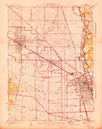
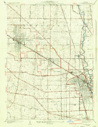
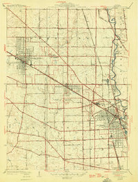
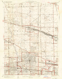
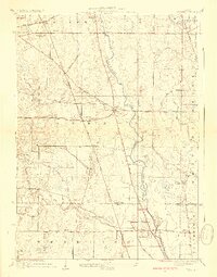
1927 Map of Arlington Heights
USGS Topo · Published 1927About this map
Arlington Heights and Mt Prospect appear as compact railroad-oriented settlements in the mid-1920s, dominated by the diagonal paths of the Chicago and Northwestern and the Minneapolis St Paul and Sault Ste Marie railroads. The landscape retains a predominantly rural character, particularly across the flats of Elk Grove and Wheeling, where small country schools like Wilson School and Boxelder School served a dispersed farming population. Near the Des Plaines River, institutional landmarks such as St Marys Training School and several cemeteries, including All Saints Cemetery and the English Cemetery, signify the area's development as a suburban periphery for Chicago.
Find a feature on this map
50 named features on this map. Tap any name to fly to it.
Don’t see what you’re looking for? This feature index may not catch every label — zoom into the map to look around manually.
Map Details
Editions of this 1927 Arlington Heights Map
3 editions found
Other maps of this area

1891 · Riverside
USGS Topo · 1:62,500

1893 · Riverside
USGS Topo · 1:62,500

1900 · Riverside
USGS Topo · 1:62,500

1900 · Highwood
USGS Topo · 1:62,500

1901 · Riverside
USGS Topo · 1:62,500

1908 · Wheaton
USGS Topo · 1:62,500

1923 · Barrington
USGS Topo · 1:62,500
1928 · Elmhurst
USGS Topo · 1:24,000
1928 · Wheeling
USGS Topo · 1:24,000
1928 · Highland Park
USGS Topo · 1:24,000