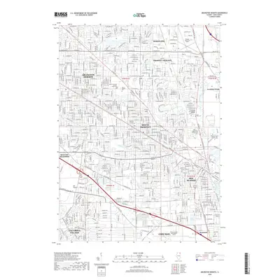
2018 Map of Arlington Heights
USGS Topo · Published 2018About this map
Arlington Heights and its neighboring Cook County suburbs appear here in their modern residential and commercial density, characterized by a complex grid of thoroughfares and active rail lines. The landscape is defined by its transit-oriented development, with the Metra line cutting through the heart of Mount Prospect and Des Plaines. Significant open space is preserved in the form of extensive cemeteries and local water features, such as the Des Plaines River and the engineered basins of Big Bend Lake and Lake Opeka. A distinct industrial and aviation footprint is visible at the Chicago Executive Airport in the north and the periphery of Chicago O'Hare International Airport to the south. Local heritage is grounded in sites like the Wheeling Township Arlington Heights Cem and institutional landmarks like the Oakton Community College - Des Plaines Campus, illustrating the long-term evolution from prairie township to integrated metropolitan hub.
Find a feature on this map
56 named features on this map. Tap any name to fly to it.
Don’t see what you’re looking for? This feature index may not catch every label — zoom into the map to look around manually.
Map Details
Editions of this 2018 Arlington Heights Map
This is the sole edition of this map. No revisions or reprints were ever made.
Other maps of this area

1891 · Riverside
USGS Topo · 1:62,500

1893 · Riverside
USGS Topo · 1:62,500

1900 · Riverside
USGS Topo · 1:62,500

1900 · Highwood
USGS Topo · 1:62,500

1901 · Riverside
USGS Topo · 1:62,500

1908 · Wheaton
USGS Topo · 1:62,500

1923 · Barrington
USGS Topo · 1:62,500

1927 · Arlington Heights
USGS Topo · 1:24,000

1928 · Elmhurst
USGS Topo · 1:24,000

1928 · Wheeling
USGS Topo · 1:24,000