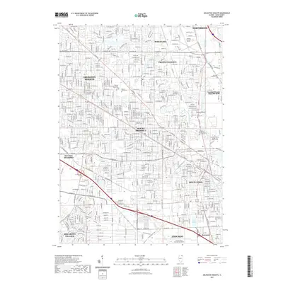
2021 Map of Arlington Heights
USGS Topo · Published 2021About this map
Arlington Heights and Mount Prospect anchor this 2021 survey, which illustrates the dense suburban grid and complex drainage network of Cook County. The landscape is defined by the convergence of the Des Plaines River and numerous tributaries like Weller Cr and Higgins Cr, which have historically shaped the development of these communities. Aviation history and transport are prominent, with the northern reach of Chicago including a portion of Chicago O'Hare International Airport and the Chicago Executive Airport further north. Genealogists will find a concentration of significant burial grounds, including the Wheeling Township Arlington Heights Cem and the All Saints Catholic Cem and Mausoleum. The map also captures the expansion of higher education in the region, noting the Oakton Community College - Des Plaines Campus and Christian-Life College.
Find a feature on this map
61 named features on this map. Tap any name to fly to it.
Don’t see what you’re looking for? This feature index may not catch every label — zoom into the map to look around manually.
Map Details
Editions of this 2021 Arlington Heights Map
This is the sole edition of this map. No revisions or reprints were ever made.
Other maps of this area

1891 · Riverside
USGS Topo · 1:62,500

1893 · Riverside
USGS Topo · 1:62,500

1900 · Riverside
USGS Topo · 1:62,500

1900 · Highwood
USGS Topo · 1:62,500

1901 · Riverside
USGS Topo · 1:62,500

1908 · Wheaton
USGS Topo · 1:62,500

1923 · Barrington
USGS Topo · 1:62,500

1927 · Arlington Heights
USGS Topo · 1:24,000

1928 · Elmhurst
USGS Topo · 1:24,000

1928 · Wheeling
USGS Topo · 1:24,000