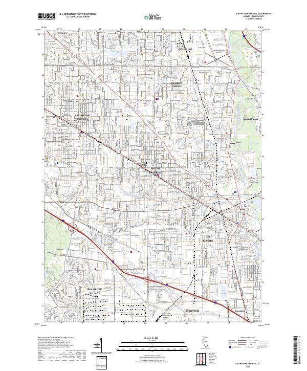
2024 Map of Arlington Heights
USGS Topo · Published 2024About this map
Chicago O'Hare International Airport and Chicago Executive Airport anchor the transportation landscape of this densely developed corridor in northwest Cook County. The urban fabric is defined by a heavy grid of major thoroughfares such as W Rand Rd and Palatine Rd, while the Metra rail line provides a critical transit link through the heart of Arlington Heights. This modern record reveals a sophisticated network of suburban centers including Mount Prospect, Wheeling, and Des Plaines. Despite the extensive infrastructure, significant green spaces and water bodies persist, notably Big Bend Lake and the winding course of the Des Plaines River. For those tracing local history or genealogy, the map identifies numerous significant burial grounds such as Memory Gardens Cem and All Saints Catholic Cem and Mausoleum, alongside educational institutions like Christian Life College.
Find a feature on this map
61 named features on this map. Tap any name to fly to it.
Don’t see what you’re looking for? This feature index may not catch every label — zoom into the map to look around manually.
Map Details
Editions of this 2024 Arlington Heights Map
This is the sole edition of this map. No revisions or reprints were ever made.
Other maps of this area

1891 · Riverside
USGS Topo · 1:62,500

1893 · Riverside
USGS Topo · 1:62,500

1900 · Riverside
USGS Topo · 1:62,500

1900 · Highwood
USGS Topo · 1:62,500

1901 · Riverside
USGS Topo · 1:62,500

1908 · Wheaton
USGS Topo · 1:62,500

1923 · Barrington
USGS Topo · 1:62,500

1927 · Arlington Heights
USGS Topo · 1:24,000

1928 · Elmhurst
USGS Topo · 1:24,000

1928 · Wheeling
USGS Topo · 1:24,000