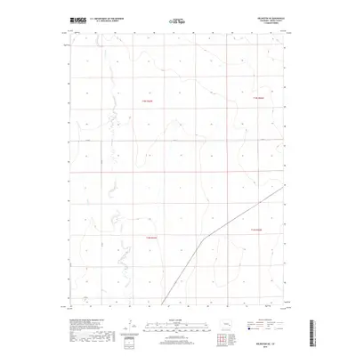
2019 Map of Arlington NE
USGS Topo · Published 2019About this map
Adobe Creek meanders through this section of the High Plains, carving a distinct drainage pattern across the landscape of Kiowa County. The terrain is defined by the ephemeral watercourses of Adobe Cr and Johns Cr, which drain the open range characteristic of this region. This 2019 survey illustrates the sparse but orderly network of rural infrastructure, where gravel and dirt routes such as Co RD P and Co RD 9 follow the Public Land Survey System grid. The map's detailed contour lines reveal the subtle elevation changes of the prairie, showing how the natural hydrology dictated the placement of local thoroughfares like Co RD J and Co RD 8. This modern data provides a clear record of the enduring agricultural and ranching layout of southeastern Colorado.
Find a feature on this map
11 named features on this map. Tap any name to fly to it.
Don’t see what you’re looking for? This feature index may not catch every label — zoom into the map to look around manually.
Map Details
Editions of this 2019 Arlington NE Map
This is the sole edition of this map. No revisions or reprints were ever made.
Other maps of this area

1891 · Arroyo
USGS Topo · 1:125,000

1891 · Las Animas
USGS Topo · 1:125,000

1893 · Arroyo
USGS Topo · 1:125,000

1893 · Las Animas
USGS Topo · 1:125,000

1954 · Lamar
USGS Topo · 1:250,000

1958 · Lamar
USGS Topo · 1:250,000

1974 · Haswell
USGS Topo · 1:24,000

1974 · Arlington NE
USGS Topo · 1:24,000
1978 · Long Lake
USGS Topo · 1:24,000
1978 · Arlington
USGS Topo · 1:24,000