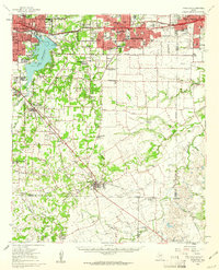
1959 Map of Arlington
USGS Topo · Published 1961About this map
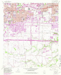
Arlington and Grand Prairie expand rapidly across the Tarrant County landscape in the late 1950s, bridging the gap toward Fort Worth. The recently created Lake Arlington dominates the western topography, while the newly constructed Fort Worth-Dallas Turnpike carves a path through the northern reach. This period shows the transition of rural homesteads into established suburbs like Dalworthington Gardens and Pantego. Educational and social institutions are well-represented, including Arlington State College and the Bible Baptist Seminary. Farther south, the environment remains largely agricultural and industrial, marked by Gravel Pits and the convergence of several major railroads including the Southern Pacific and Missouri Pacific. The southern boundary near Lillian and Britton remains dominated by creek systems like Walnut Creek and Mountain Creek, preserving the layout of older settlements before the intensification of the DFW metroplex.
Find a feature on this map
87 named features on this map. Tap any name to fly to it.
Don’t see what you’re looking for? This feature index may not catch every label — zoom into the map to look around manually.
Map Details
Editions of this 1959 Arlington Map
This is the sole edition of this map. No revisions or reprints were ever made.
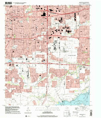
Historical Maps of Dallas Through Time
8 maps found