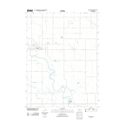
2011 Map of Arlington
USGS Topo · Published 2011About this map
The Arlington village landscape is defined by the winding course of the Elkhorn River and its complex relationship with local hydrology. This 2011 survey captures the town's character as a regional hub, anchored by the Washington County Fair Grounds and the Arlington Post Office. The surrounding agricultural terrain is etched with waterways like Bell Creek and Rawhide Creek, including the clearly marked Rawhide Creek (Old Channel), which reveals the shifting nature of the local drainage system. Local history is preserved in the Arlington Cemetery and the Seventh Day Adventist Cemetery, while modern land use is represented by Sibbernsen Airport and the Dunklau Dairy. The presence of the Lang Dam and Lang Reservoir further illustrates the management of water resources in this part of Washington County, supporting the rural and residential communities that have grown along these fertile Nebraska banks.
Find a feature on this map
36 named features on this map. Tap any name to fly to it.
Don’t see what you’re looking for? This feature index may not catch every label — zoom into the map to look around manually.
Map Details
Editions of this 2011 Arlington Map
This is the sole edition of this map. No revisions or reprints were ever made.
Other maps of this area

1893 · Fremont
USGS Topo · 1:125,000

1896 · Fremont
USGS Topo · 1:125,000

1955 · Fremont
USGS Topo · 1:250,000

1957 · Fremont
USGS Topo · 1:250,000

1958 · Fremont
USGS Topo · 1:250,000

1966 · Nickerson
USGS Topo · 1:24,000

1968 · Valley
USGS Topo · 1:24,000

1968 · Leshara
USGS Topo · 1:24,000

1968 · Fremont East
USGS Topo · 1:24,000

1968 · Kennard
USGS Topo · 1:24,000