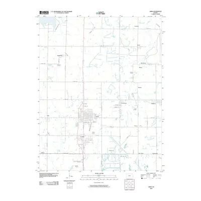
2009 Map of Arma
USGS Topo · Published 2009About this map
Arma and its neighboring coal-era settlements define this corner of Crawford County, where a dense grid of rural roads connects historically significant communities. The landscape is marked by the proximity of Franklin, Croweburg, and Mulberry, reflecting a legacy of industrial activity and early 20th-century growth. To the north, the names Coalvale and Gross hint at the region's mining heritage, while localized landmarks like Bunker Hill and First Cow Creek break the agricultural grid. Genealogists will find notable burial grounds including Englevale Cemetery, Smilie Cemetery, and the Garden of Memories Cemetery located near Edison. Transportation and local infrastructure are represented by both the Youvan Airport and Galichia Airport, as well as distinctive local naming conventions like Old Haul RD and Trianon RD. This survey provides a clear look at the residential clusters of Polk, Barber, and Fox Town, capturing the spatial relationship between these small Kansas centers.
Find a feature on this map
69 named features on this map. Tap any name to fly to it.
Don’t see what you’re looking for? This feature index may not catch every label — zoom into the map to look around manually.
Map Details
Editions of this 2009 Arma Map
This is the sole edition of this map. No revisions or reprints were ever made.
Other maps of this area

1884 · Fort Scott
USGS Topo · 1:125,000

1886 · Joplin
USGS Topo · 1:125,000

1886 · Fort Scott
USGS Topo · 1:125,000

1893 · Fort Scott
USGS Topo · 1:125,000

1894 · Joplin
USGS Topo · 1:125,000

1943 · Cherokee
USGS Topo · 1:62,500

1945 · Pittsburg
USGS Topo · 1:62,500

1945 · Cherokee
USGS Topo · 1:62,500

1947 · Joplin
USGS Topo · 1:250,000

1947 · Pittsburg
USGS Topo · 1:62,500