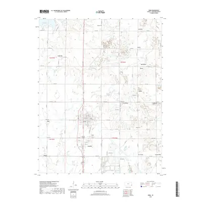
2018 Map of Arma
USGS Topo · Published 2018About this map
Arma serves as the central hub of this Crawford County landscape, where the residential grids of Franklin and Croweburg reflect the settlement patterns of southeast Kansas. The terrain is defined by the headwaters of Cox Cr and First Cow Cr, along with the significant footprint of Bone Creek Reservoir in the northwest. Local history is deeply embedded in the land through numerous small burial sites, including the Smilie Cem and Englevale Cem, which often represent the only remaining physical links to the early coal-mining communities of the region. The map reveals a transition from these clustered towns into the open surrounding country, where landmarks like Bunker Hill and the Youvan Airport break the agricultural expanse. Smaller locales such as Red Onion, Gross, and Breezy Hill appear as named points, preserving the identity of rural neighborhoods that shaped the county's social geography.
Find a feature on this map
119 named features on this map. Tap any name to fly to it.
Don’t see what you’re looking for? This feature index may not catch every label — zoom into the map to look around manually.
Map Details
Editions of this 2018 Arma Map
This is the sole edition of this map. No revisions or reprints were ever made.
Other maps of this area

1884 · Fort Scott
USGS Topo · 1:125,000

1886 · Joplin
USGS Topo · 1:125,000

1886 · Fort Scott
USGS Topo · 1:125,000

1893 · Fort Scott
USGS Topo · 1:125,000

1894 · Joplin
USGS Topo · 1:125,000

1943 · Cherokee
USGS Topo · 1:62,500

1945 · Pittsburg
USGS Topo · 1:62,500

1945 · Cherokee
USGS Topo · 1:62,500

1947 · Joplin
USGS Topo · 1:250,000

1947 · Pittsburg
USGS Topo · 1:62,500