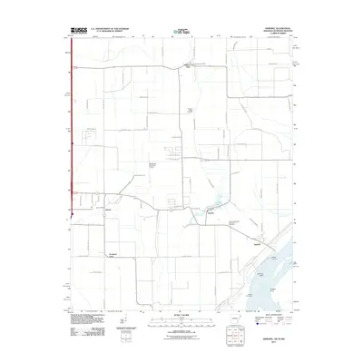
2011 Map of Armorel
USGS Topo · Published 2011About this map
The Mississippi River defines the southeastern edge of this Mississippi County landscape, where the Barfield Revetment and Barfield Bend show the managed engineering of the river's path. Inland, the terrain is dominated by an extensive drainage network, including Ditch Number 46 and Ditch Number 44, supporting the agricultural character of communities like Number Nine and Promised Land. This survey documents the area just east of Blytheville, centered on the settlement of Armorel and its local landmarks such as the Armorel Vol Fire Dept. For those tracing local heritage, several historic burial grounds are clearly marked, including the African Methodist Episcopal Cemetery near the river and the Pleasant Ridge Cemetery further north. The infrastructure reflects a mix of aviation at the Blytheville Municipal Airport and traditional riverfront activity at Barfield Landing.
Find a feature on this map
65 named features on this map. Tap any name to fly to it.
Don’t see what you’re looking for? This feature index may not catch every label — zoom into the map to look around manually.
Map Details
Editions of this 2011 Armorel Map
This is the sole edition of this map. No revisions or reprints were ever made.
Other maps of this area

1939 · Hales Point
USGS Topo · 1:62,500

1939 · Caruthersville
USGS Topo · 1:62,500

1939 · Blytheville
USGS Topo · 1:62,500

1940 · Hayti
USGS Topo · 1:62,500

1951 · Caruthersville
USGS Topo · 1:62,500

1952 · Hales Point
USGS Topo · 1:62,500

1955 · Hayti
USGS Topo · 1:62,500

1955 · Blytheville
USGS Topo · 1:62,500

1956 · Dyersburg
USGS Topo · 1:250,000

1956 · Blytheville
USGS Topo · 1:250,000