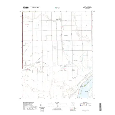
2020 Map of Armorel
USGS Topo · Published 2020About this map
Blytheville dominates the western edge of this Mississippi County survey, where the eastern reach of E Main St and State Hwy 18 lead toward the riverfront. The landscape is defined by an extensive drainage network, including Ditch Number 30, Ditch Number 51, and Crooked Lake Bayou, reflecting the heavy engineering required to manage the fertile delta lowlands. Smaller settlements like Armorel, Burton, and Barfield are scattered along these primary routes, while the curious name of Number Nine marks a community further north near the border.
Find a feature on this map
59 named features on this map. Tap any name to fly to it.
Don’t see what you’re looking for? This feature index may not catch every label — zoom into the map to look around manually.
Map Details
Editions of this 2020 Armorel Map
This is the sole edition of this map. No revisions or reprints were ever made.
Other maps of this area

1939 · Hales Point
USGS Topo · 1:62,500

1939 · Caruthersville
USGS Topo · 1:62,500

1939 · Blytheville
USGS Topo · 1:62,500

1940 · Hayti
USGS Topo · 1:62,500

1951 · Caruthersville
USGS Topo · 1:62,500

1952 · Hales Point
USGS Topo · 1:62,500

1955 · Hayti
USGS Topo · 1:62,500

1955 · Blytheville
USGS Topo · 1:62,500

1956 · Dyersburg
USGS Topo · 1:250,000

1956 · Blytheville
USGS Topo · 1:250,000