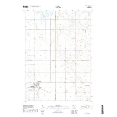
2018 Map of Armstrong
USGS Topo · Published 2018About this map
Armstrong serves as the primary hub of activity in this northern Iowa landscape, positioned near the intersection of several significant local thoroughfares and the East Fork Des Moines River. The town's grid is well-defined by residential avenues like 2nd Ave and S 4th Ave, transitioning quickly into the section-line road network of Emmet and Kossuth counties. This 2018 survey illustrates a region shaped by agricultural drainage and glacial remnants, where natural features like Goose Lake and Swag Lake coexist with engineered waterways such as Ditch Number 35. To the southeast, the Swea Township Cem provides a point of genealogical interest for those tracing family roots in the neighboring township. The landscape is further defined by the meandering path of Mud Cr as it flows toward the river valley, marking the boundary between the prairie uplands and the river bottomlands.
Find a feature on this map
37 named features on this map. Tap any name to fly to it.
Don’t see what you’re looking for? This feature index may not catch every label — zoom into the map to look around manually.
Map Details
Editions of this 2018 Armstrong Map
This is the sole edition of this map. No revisions or reprints were ever made.
Other maps of this area

1954 · Fairmont
USGS Topo · 1:250,000

1958 · Fairmont
USGS Topo · 1:250,000

1967 · East Chain
USGS Topo · 1:24,000

1967 · Wilmert Lake
USGS Topo · 1:24,000

1970 · Wilbert
USGS Topo · 1:24,000

1980 · Seneca
USGS Topo · 1:24,000

1980 · Armstrong
USGS Topo · 1:24,000

1980 · Ringsted
USGS Topo · 1:24,000

1980 · Swea City
USGS Topo · 1:24,000

1980 · Armstrong SE
USGS Topo · 1:24,000