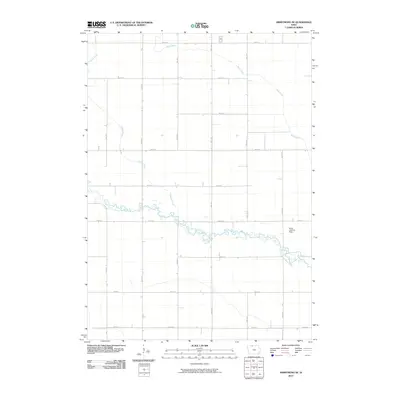
2010 Map of Armstrong SE
USGS Topo · Published 2010About this map
The East Fork Des Moines River winds its way across this section of Kossuth County, creating a meandering riparian corridor that breaks the rigid geometry of the surrounding agricultural grid. This landscape is defined by the Jeffersonian survey system, where north-south avenues like 90th Ave and east-west streets like 370th St divide the prairie into uniform sections. While the terrain is primarily devoted to large-scale farming, localized landmarks such as the Buaer Landing Strip suggest the intersection of rural life and private aviation. Tributaries including Prairie Creek and Mud Creek feed into the river system, while Calamus Creek skims the southern edge, illustrating the natural drainage patterns of this fertile Iowa region.
Find a feature on this map
20 named features on this map. Tap any name to fly to it.
Don’t see what you’re looking for? This feature index may not catch every label — zoom into the map to look around manually.
Map Details
Editions of this 2010 Armstrong SE Map
This is the sole edition of this map. No revisions or reprints were ever made.
Other maps of this area

1954 · Fairmont
USGS Topo · 1:250,000

1958 · Fairmont
USGS Topo · 1:250,000

1972 · Bancroft
USGS Topo · 1:24,000

1972 · Burt
USGS Topo · 1:24,000

1972 · Ledyard
USGS Topo · 1:24,000

1980 · Lone Rock
USGS Topo · 1:24,000

1980 · Fenton
USGS Topo · 1:24,000

1980 · Seneca
USGS Topo · 1:24,000

1980 · Armstrong
USGS Topo · 1:24,000

1980 · Swea City
USGS Topo · 1:24,000