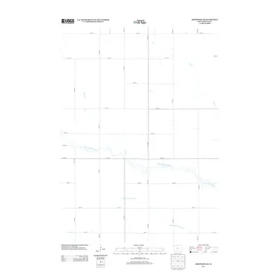
2013 Map of Armstrong SE
USGS Topo · Published 2013About this map
The E Fork Des Moines River winds with intricate oxbows through this agricultural section of Kossuth County. The landscape is defined by its drainage patterns, where natural waterways like Prairie Cr and Mud Cr are supplemented by man-made engineering such as Drainage Ditch Number 69. This network of water management reflects the region's intensive conversion of prairie wetlands into highly productive farmland. The map reveals a precise grid of rural roads, including 380th St and 80th Ave, which partition the terrain into the uniform square-mile sections characteristic of the Midwest. Apart from the meandering river corridor, the terrain is notably flat, allowing for the vast agricultural infrastructure visible in the southern reaches near Calamus Cr.
Find a feature on this map
21 named features on this map. Tap any name to fly to it.
Don’t see what you’re looking for? This feature index may not catch every label — zoom into the map to look around manually.
Map Details
Editions of this 2013 Armstrong SE Map
This is the sole edition of this map. No revisions or reprints were ever made.
Other maps of this area

1954 · Fairmont
USGS Topo · 1:250,000

1958 · Fairmont
USGS Topo · 1:250,000

1972 · Bancroft
USGS Topo · 1:24,000

1972 · Burt
USGS Topo · 1:24,000

1972 · Ledyard
USGS Topo · 1:24,000

1980 · Lone Rock
USGS Topo · 1:24,000

1980 · Fenton
USGS Topo · 1:24,000

1980 · Seneca
USGS Topo · 1:24,000

1980 · Armstrong
USGS Topo · 1:24,000

1980 · Swea City
USGS Topo · 1:24,000