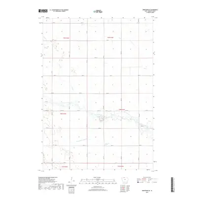
2018 Map of Armstrong SE
USGS Topo · Published 2018About this map
The East Fork Des Moines River meanders across this rural Kossuth County landscape, defining the local geography alongside several significant tributaries. To the north, Mud Cr and Prairie Cr drain the glacial plains, while Calamus Cr occupies the southern reaches of the township. The presence of Greenwood Marsh and the engineered Drainage Ditch Number 69 illustrates the complex relationship between the region's natural wetlands and the intensive agricultural development that has shaped northern Iowa. This survey documents the rigid section-line road grid, including Co Hwy A42, which segments the land into the productive farmsteads characteristic of the Prairie Pothole Region.
Find a feature on this map
30 named features on this map. Tap any name to fly to it.
Don’t see what you’re looking for? This feature index may not catch every label — zoom into the map to look around manually.
Map Details
Editions of this 2018 Armstrong SE Map
This is the sole edition of this map. No revisions or reprints were ever made.
Other maps of this area

1954 · Fairmont
USGS Topo · 1:250,000

1958 · Fairmont
USGS Topo · 1:250,000

1972 · Bancroft
USGS Topo · 1:24,000

1972 · Burt
USGS Topo · 1:24,000

1972 · Ledyard
USGS Topo · 1:24,000

1980 · Lone Rock
USGS Topo · 1:24,000

1980 · Fenton
USGS Topo · 1:24,000

1980 · Seneca
USGS Topo · 1:24,000

1980 · Armstrong
USGS Topo · 1:24,000

1980 · Swea City
USGS Topo · 1:24,000