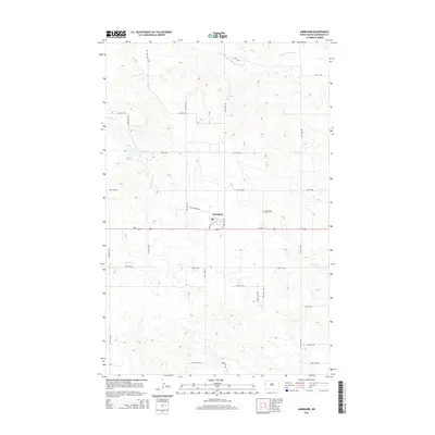
2014 Map of Arnegard
USGS Topo · Published 2014About this map
Arnegard serves as the central hub of this North Dakota landscape, situated along the east-west corridor of Us-85. The settlement's grid is anchored by Main St and surrounded by a vast network of section roads like 29th St NW and 134th Ave NW, reflecting the systematic agricultural development of McKenzie County. To the northeast, the Wilmington Cem stands as a significant site for genealogical research, marking the community's ancestral roots.
Find a feature on this map
23 named features on this map. Tap any name to fly to it.
Don’t see what you’re looking for? This feature index may not catch every label — zoom into the map to look around manually.
Map Details
Editions of this 2014 Arnegard Map
This is the sole edition of this map. No revisions or reprints were ever made.
Other maps of this area

1953 · Watford City
USGS Topo · 1:250,000

1957 · Watford City
USGS Topo · 1:250,000

1958 · Stocke Butte
USGS Topo · 1:24,000

1958 · Tepee Buttes
USGS Topo · 1:24,000

1967 · Watford City
USGS Topo · 1:250,000

1972 · Bear Butte
USGS Topo · 1:24,000

1972 · Rawson
USGS Topo · 1:24,000

1978 · Watford City NW
USGS Topo · 1:24,000

1978 · Arnegard
USGS Topo · 1:24,000
1978 · Camp Creek East
USGS Topo · 1:24,000