
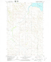
1978 Map of Arnegard
USGS Topo · Published 1979About this map
Arnegard serves as the central hub of this McKenzie County landscape, situated along the Burlington Northern railroad line in the late 1970s. The settlement's infrastructure is clearly defined, featuring a local Park and Sewage Disposal Ponds at its periphery. To the north, the Arnegard Dam regulates the flow of Timber Creek, which winds southward through the plains. The surrounding territory is organized into large tracts such as Patent Gate and Arnegard Ideal, reflecting the agricultural and land-grant history of the North Dakota prairie.
Find a feature on this map
11 named features on this map. Tap any name to fly to it.
Don’t see what you’re looking for? This feature index may not catch every label — zoom into the map to look around manually.
Map Details
Editions of this 1978 Arnegard Map
This is the sole edition of this map. No revisions or reprints were ever made.
Other maps of this area

1953 · Watford City
USGS Topo · 1:250,000

1957 · Watford City
USGS Topo · 1:250,000

1958 · Stocke Butte
USGS Topo · 1:24,000

1958 · Tepee Buttes
USGS Topo · 1:24,000

1967 · Watford City
USGS Topo · 1:250,000

1972 · Bear Butte
USGS Topo · 1:24,000

1972 · Rawson
USGS Topo · 1:24,000

1978 · Watford City NW
USGS Topo · 1:24,000
1978 · Camp Creek East
USGS Topo · 1:24,000

1978 · Watford City NE
USGS Topo · 1:24,000