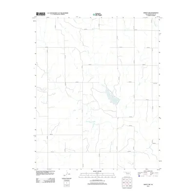
2012 Map of Arnett SW
USGS Topo · Published 2012About this map
Lake Lloyd Vincent serves as a central hydrological feature in this section of western Oklahoma, where numerous seasonal watercourses carve through the Ellis County plains. Fed by the northern reaches of Coon Cr, the lake provides a significant catchment in a landscape otherwise defined by the dendritic patterns of Hog Cr and its western tributary, W Hog Cr. The section-line road network, including N1730 Rd and E0650 Rd, reflects the systematic agrarian layout of the region, providing access to remote landmarks like the Allmon Cem and the Stobaugh Number 1 Reservoir. This 2012 survey illustrates a quiet rural expanse where water management is critical to the local geography, showing how small reservoirs and creeks like W Red Bluff Cr dictate the placement of livestock and agricultural infrastructure.
Find a feature on this map
24 named features on this map. Tap any name to fly to it.
Don’t see what you’re looking for? This feature index may not catch every label — zoom into the map to look around manually.
Map Details
Editions of this 2012 Arnett SW Map
This is the sole edition of this map. No revisions or reprints were ever made.
Other maps of this area

1954 · Perryton
USGS Topo · 1:250,000

1954 · Amarillo
USGS Topo · 1:250,000

1955 · Clinton
USGS Topo · 1:250,000

1955 · Woodward
USGS Topo · 1:250,000

1957 · Clinton
USGS Topo · 1:250,000

1958 · Perryton
USGS Topo · 1:250,000

1958 · Woodward
USGS Topo · 1:250,000

1958 · Amarillo
USGS Topo · 1:250,000

1966 · Antelope Hills NE
USGS Topo · 1:24,000

1966 · Antelope Hills
USGS Topo · 1:24,000