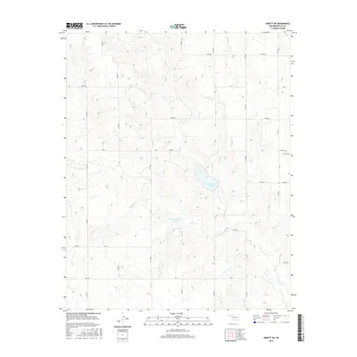
2016 Map of Arnett SW
USGS Topo · Published 2016About this map
Lake Lloyd Vincent serves as the central geographic landmark of this western Oklahoma landscape, where the High Plains terrain is deeply incised by a network of seasonal drainages. This hydrological pattern, dominated by Coon Cr and the various branches of Hog Cr, dictates the layout of the rural road grid that divides the land into sections. The reservoir and its nearby Stobough Number 1 Reservoir represent modern water management efforts in an area otherwise defined by its agricultural openness and the sparse distribution of permanent landmarks.
Find a feature on this map
32 named features on this map. Tap any name to fly to it.
Don’t see what you’re looking for? This feature index may not catch every label — zoom into the map to look around manually.
Map Details
Editions of this 2016 Arnett SW Map
This is the sole edition of this map. No revisions or reprints were ever made.
Other maps of this area

1954 · Perryton
USGS Topo · 1:250,000

1954 · Amarillo
USGS Topo · 1:250,000

1955 · Clinton
USGS Topo · 1:250,000

1955 · Woodward
USGS Topo · 1:250,000

1957 · Clinton
USGS Topo · 1:250,000

1958 · Perryton
USGS Topo · 1:250,000

1958 · Woodward
USGS Topo · 1:250,000

1958 · Amarillo
USGS Topo · 1:250,000

1966 · Antelope Hills NE
USGS Topo · 1:24,000

1966 · Antelope Hills
USGS Topo · 1:24,000