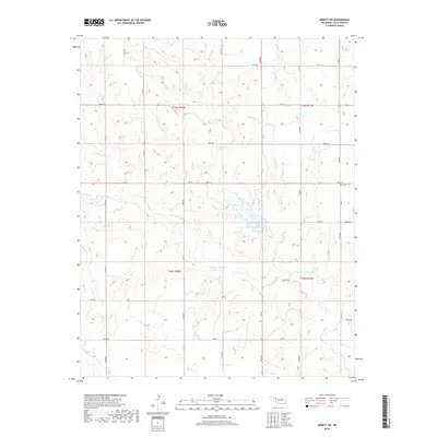
2018 Map of Arnett SW
USGS Topo · Published 2018About this map
Lake Lloyd Vincent forms a significant hydrological focal point in this portion of Ellis County, drawing together the waters of Coon Cr and W Hog Cr. The landscape is defined by a strictly organized section-line road network, including routes like N1710 Rd and Ew 65, which partition the terrain into a predictable agricultural and ranching grid. Further south, the Stobough Number 1 Reservoir provides additional water management in an area characterized by the branching drainages of Hog Cr. For those researching local family history, the Allmon Cem sits near the eastern boundary, offering a specific point of reference for genealogy and land use. The map illustrates the persistent intersection of natural watercourses with the human-imposed geometry of the Public Land Survey System in western Oklahoma.
Find a feature on this map
36 named features on this map. Tap any name to fly to it.
Don’t see what you’re looking for? This feature index may not catch every label — zoom into the map to look around manually.
Map Details
Editions of this 2018 Arnett SW Map
This is the sole edition of this map. No revisions or reprints were ever made.
Other maps of this area

1954 · Perryton
USGS Topo · 1:250,000

1954 · Amarillo
USGS Topo · 1:250,000

1955 · Clinton
USGS Topo · 1:250,000

1955 · Woodward
USGS Topo · 1:250,000

1957 · Clinton
USGS Topo · 1:250,000

1958 · Perryton
USGS Topo · 1:250,000

1958 · Woodward
USGS Topo · 1:250,000

1958 · Amarillo
USGS Topo · 1:250,000

1966 · Antelope Hills NE
USGS Topo · 1:24,000

1966 · Antelope Hills
USGS Topo · 1:24,000