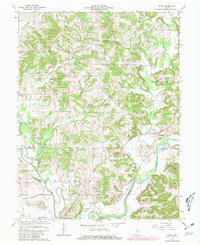
1966 Map of Arney
USGS Topo · Published 1981About this map
The West Fork White River winds through the rural borderlands of Owen and Greene counties, shaping the settlement patterns of this central Indiana landscape. Near the river, the historic site of Point Commerce and the crossing at Farmers Ferry reflect a landscape defined by water and rail transport, including the Conrail lines that trace the valley. The terrain is marked by family-named landmarks like Dillon Hill and Kelley Ridge, which rise above a network of smaller drainages such as Fish Creek and Buckhall Creek.
Find a feature on this map
36 named features on this map. Tap any name to fly to it.
Don’t see what you’re looking for? This feature index may not catch every label — zoom into the map to look around manually.
Map Details
Editions of this 1966 Arney Map
Other maps of this area

1908 · Clay City
USGS Topo · 1:48,000

1908 · Bloomfield
USGS Topo · 1:62,500

1910 · Clay City
USGS Topo · 1:62,500

1938 · Coal City
USGS Topo · 1:24,000

1938 · Switz City
USGS Topo · 1:24,000

1947 · Switz City
USGS Topo · 1:24,000

1948 · Coal City
USGS Topo · 1:24,000

1950 · Arney
USGS Topo · 1:24,000

1950 · Switz City
USGS Topo · 1:24,000

1951 · Bloomfield
USGS Topo · 1:24,000